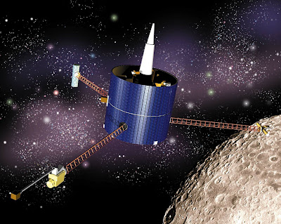
It is simply impractical to park a Donosev survey ship and its crew in orbit around a planet for a few years while it does the surveying. Unmanned satellites are the more economical and reasonable option. However, sat surveys have limitations too. At high altitudes, a sat with optical or visible light cameras can see a lot, but not in any useful detail. The standard Traveller world map is a good representation of the problem.
Look at the map of Earth as presented in the game Invasion:Earth. The area of the continental United States is covered in four hexes. Three thousand miles in four hexes? Each hex is 713 miles in width. There is, for all practical purposes, NO detail of the surface available from that map. Even the hex that represents the Rocky Mountains is so vague as to be almost useless. Humans don’t live and act at that scale. The continental US has almost every type of terrain found on this planet, from swamps to river deltas to deserts to mountains, foothills and coastal plains. None of that is depicted on the I:E map.

See what I mean about lack of detail? Can you tell where the Appalachian mountains are from this photo?
That is the kind of representation that a high orbital satellite provides. It’s quick and easy to do but provides the most meager information.
The reverse is true as well. A camera sat might focus on a single square kilometer, or 10 meter square of the surface, and produce a very detailed image. But only for that one square. What is adjacent to it? What terrain must be crossed to get to it? How long did the sat take to find that one spot – a week, a month, years? Satellites orbit, and for this reason, are able to look at any one spot for a limited time each time it goes around. Maybe not much changes from one orbit to the next, but maybe something does.
There
is also the issue of planets having day/night cycles which limit visibility on
the ground. Weather or atmospheric composition may also inhibit or prevent sats
in orbit from seeing the ground clearly. Vegetation (trees!) or other surface features might obscure ground targets. Even shadows of large objects can hamper identification. A planet like our Moon, with little or no atmosphere to diffuse or scatter sunlight will have deep dark shadows.
<Random dig> In the Star Trek shows and movies, the Enterprise can arrive at a planet, settle into a ‘standard orbit’ and a few minutes later have a report ready for the Captain about what the planet is all about. This is not scientific; it is magic-tech and a plot convenience. A few minutes work to analyze millions of cubic kilometers of atmosphere for composition, temperature, weather and everything the plot needs to keep rolling along. <Random dig over>
Having said that, as Tech Levels rise, the capability of orbital satellite surveys should improve as well. First, however, will be reductions in base costs and in mass of the satellite, and improvements in endurance. Other areas of improvement might be counter-measures and self-defense for the sat; ability to scan for multiple types of emissions or signals; better clarity or granularity in scan results or imagery. As long as the sat does not cross over into magic-tech (whatever that means in YTU) upgrades can be sought and used. The fancier the detection gear the higher the price, though.
Scanning the planet to catalog its physical composition has its own issues. Even assuming that a sat in orbit can detect, by “high tech” means, the presence of useful metals and minerals, it will be a long slow process because of the planet-sized volume of mass to scan through. A general query of “give the mineral composition of that mountain” is asking for an analysis of millions of cubic meters of mass.
What specific things should be scanned for? By what means will they be detected, and distinguished from all the other stuff down there? Where should the scanner look? A continent-wide scan may not tell any more than “somewhere between this horizon and that one, you’ll find some amount of the thing you are looking for”. If the sat scans a smaller area, then the number of such areas to look at increases exponentially, and so does the amount of time required. How deep into the surface can/should the scanners ‘look’? What concentration or magnitude of deposit should return a ‘success’ on the scan?
What is to be done with these observations?
I say this to make the case that exploration in Traveller is a viable course for adventure (the point of the game). If the planetary government (PG) or a megacorp wants to know where the exploitable resources or the bandit headquarters is, they either must wait 5-20 years for the survey sat to do it, or put teams of Travellers on the ground/near the ground with sensors and equipment to get detailed studies of particular areas.
Looking
for people on the ground has even more complications. People on the ground may
not want to be found, so they will take measures to avoid that. Measures like camouflage,
decoys and moving their equipment to defeat the observations of the local
government. NPCs on the ground might even use scanners of their own to locate
the sats in orbit, and then take direct action to knock them out. Lasers come
into use at TL-7 and get better from there. Air/rafts can, according to TTB, make it to orbit, so NPCs can attack sats directly. How to defend against such attacks, to say nothing of random space debris, is yet another layer of complication in using satellites.
Checking up on or repairing or retrieving survey satellites can be jobs for PCs as well. Taken from the other end, PCs could be hired to hinder/neutralize satellites belonging to the patron's enemies. A pirate base, or smuggling group operating in an ungoverned space on a planet might not want spy-sats looking for them.
Extraction is a business, not an adventure. Let NPCs do the mining, while the PCs handle the weather, terrain, animals and bandits on the ground. As well as the corporate spies, saboteurs and claim jumpers who want to prevent the PCs or their patrons from succeeding.
The possibilities for adventure are as wide as the worlds.
Some nice ideas in there, thanks. It would be interesting to figure out TL scanning devices and all that, expand on the old World Builders stuff (I only have Grand Census but really enjoy the idea of some of the tools there like the NAS scanner)
ReplyDeleteThe factors that should 'scale up' as the satellite tech level increases are the size/volume of the sats (reduce), the overall cost (reduce), the life cycle (extend), sensor penetration (improve), resolution (improve), and time-on-target.
DeleteMaybe I could make up some rules for attacking & defending sats from space or from the ground. My source material (from the 90's) indicates that US 'spy' satellites can cost into the 100's of millions of dollars. Basing satellite design on Small Craft design will keep the prices in the same range.